|
|
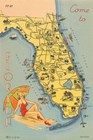
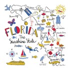
Florida Postcard VI
Fine-Art Print
12" x 18"
$41.99
Ships within 2-3 days
|
|
|
|
|
|
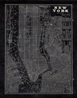
Blueprint Map New York
Fine-Art Print
16" x 20"
$52.99
Ships within 2-3 days
|
|
|
|
|
|
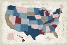
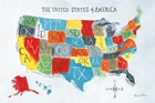
USA Modern Vintage Blue
Fine-Art Print
24" x 16"
$58.99
Ships within 2-3 days
|
|
|
|

|
|
US Cities II
Fine-Art Print
18" x 18"
$52.99
Ships within 2-3 days
|
|
|
|

|
|
US Cities VI
Fine-Art Print
18" x 18"
$52.99
Ships within 2-3 days
|
|
|
|
|
|
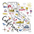
California
Fine-Art Print
12" x 12"
$32.99
Ships within 2-3 days
|
|
|
|
|
|
Florida
Fine-Art Print
12" x 12"
$32.99
Ships within 2-3 days
|
|
|
|
|
|
Peace and Lodge USA Map
Fine-Art Print
24" x 16"
$58.99
Ships within 2-3 days
|
|
|
|

|
|
Vintage USA on Indigo
Fine-Art Print
24" x 16"
$58.99
Ships within 2-3 days
|
|
|
|

|
|
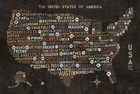
See the USA Americana BW
Fine-Art Print
24" x 16"
$58.99
Ships within 2-3 days
|
|
|
|

|
|
Grunge USA Map
Fine-Art Print
24" x 16"
$58.99
Ships within 2-3 days
|
|
|
|
|
|
Riveting USA Map
Fine-Art Print
24" x 18"
$62.99
Ships within 2-3 days
|
|
|
|
|
|
US City Map Black
Fine-Art Print
24" x 16"
$58.99
Ships within 2-3 days
|
|
|
|
|
|
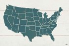
US Map
Fine-Art Print
18" x 12"
$41.99
Ships within 2-3 days
|
|
|
|

|
|
Wild Garden USA
Fine-Art Print
24" x 16"
$58.99
Ships within 2-3 days
|
|
|
|
|
|
Hand Lettered USA Map Gray
Fine-Art Print
18" x 12"
$41.99
Ships within 2-3 days
|
|
|
|
|
|
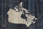
Old World Map Blue Canada
Fine-Art Print
18" x 12"
$41.99
Ships within 2-3 days
|
|
|
|
|
|
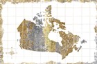
Gilded Map Canada
Fine-Art Print
18" x 12"
$41.99
Ships within 2-3 days
|
|
|
|

|
|
InstaStates I
Fine-Art Print
16" x 20"
$52.99
Ships within 2-3 days
|
|
|
|

|
|
InstaStates IV
Fine-Art Print
16" x 20"
$52.99
Ships within 2-3 days
|
|
|
|

|
|
InstaStates III
Fine-Art Print
16" x 20"
$52.99
Ships within 2-3 days
|
|
|
|

|
|
InstaStates IV Dark
Fine-Art Print
16" x 20"
$52.99
Ships within 2-3 days
|
|
|
|

|
|
InstaStates II Dark
Fine-Art Print
16" x 20"
$52.99
Ships within 2-3 days
|
|
|
|

|
|
InstaStates VIII Dark
Fine-Art Print
20" x 12"
$43.99
Ships within 2-3 days
|
|
|
|