Gilles Robert De Vaugondy Art Prints
Gilles Robert de Vaugondy succeeded Pierre Sanson as Geographer to the King of France in 1730.
Born in 1686, de Vaugondy was one of the most important cartographers and publishers of his day and several important atlases were issued in his name between 1735 and his death in 1766.
He was also known as “le Sieur” and he and his son, Didier Robert de Vaugondy (1723-1786), were leading mapmakers in France in the 18th century. Perhaps their most significant publication was “The Atlas Universel” of 1757, which combined older sources inherited from their eminent Sanson ancestors, with more modern surveyed maps. Rather than copying existing maps, they verified and corrected much of what had been produced before, using astronomical observations.
Their maps and terrestrial globes were produced working together as father and son, and in some cases it is uncertain whether Gilles or Didier produced each map. Gilles often signed maps as “M Robert”, whilst Didier commonly signed his maps as “Robert de Vaugondy” or added “fils” or “filio” after his name.

|
|
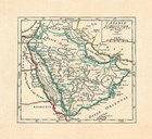
L'arabie, 1749
Fine-Art Print
24" x 21"
$356.99
Ships within 6-8 days
|
|
|
| | |
